Model Answer:
Anthropogenic Land-Use and Land-Cover (LULC) changes, driven by India’s demographic and economic expansion, have drastically altered physical landscapes, with ISRO’s Desertification Atlas recording 29.7% of India’s Total Geographical Area (TGA) under degradation.
Major Drivers of Human-Induced Land-Use Changes
- Agricultural Intensification & Encroachment: Conversion of virgin forests and common grasslands into intensive monocultures (e.g., Terai belt clearing; shorten fallow cycles in Jhum areas).
- Unplanned Peri-Urban Sprawl: Unregulated conversion of fertile agricultural tracts and natural wetlands into built-up zones (e.g., East Kolkata Wetlands, Bengaluru lake beds).
- Linear Infrastructure & Hydro-Projects: Heavy engineering, tunneling, and slope-cutting through ecologically fragile biomes (e.g., Char Dham Highway in the Himalayas).
- Extractive Mining & Quarrying: Large-scale open-cast operations stripping overburden and forest canopies (e.g., Chhota Nagpur plateau; illegal sand and stone mining in Aravallis).
Geographical Consequences
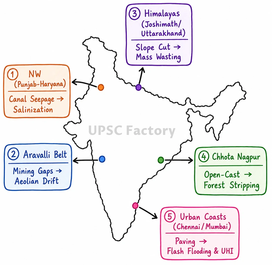
- Geomorphological Instability: Slope destabilization and accelerated mass wasting, triggering devastating debris flows and subsidence (e.g., Joshimath sinking; 2024 Wayanad landslides).
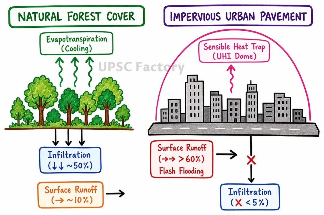
- Hydrological Regime Disruption: Surface impermeabilization reduces groundwater recharge, increases surface runoff, and triggers recurring urban flash floods (e.g., Chennai and Mumbai floods).
- Micro-Climatic Shifts: Replacement of vegetation with concrete lowers surface albedo and increases sensible heat flux, intensifying the Urban Heat Island (UHI) effect (e.g., Delhi-NCR).
- Pedological Deterioration: Extensive canal irrigation and deforestation induce severe soil salinization, waterlogging, and soil organic carbon depletion (e.g., Green Revolution belt of Punjab-Haryana).
- Desertification & Aeolian Drift: Mining-induced gaps in the Aravalli range act as conduits for windward sand transport, accelerating Thar desertification eastward.
Achieving Land Degradation Neutrality (SDG 15.3) necessitates integrated spatial planning, stringent eco-sensitive zoning, and catchment-level ecological restoration to meet India’s target of restoring 26 million hectares by 2030.