UPPSC Prelims 2024
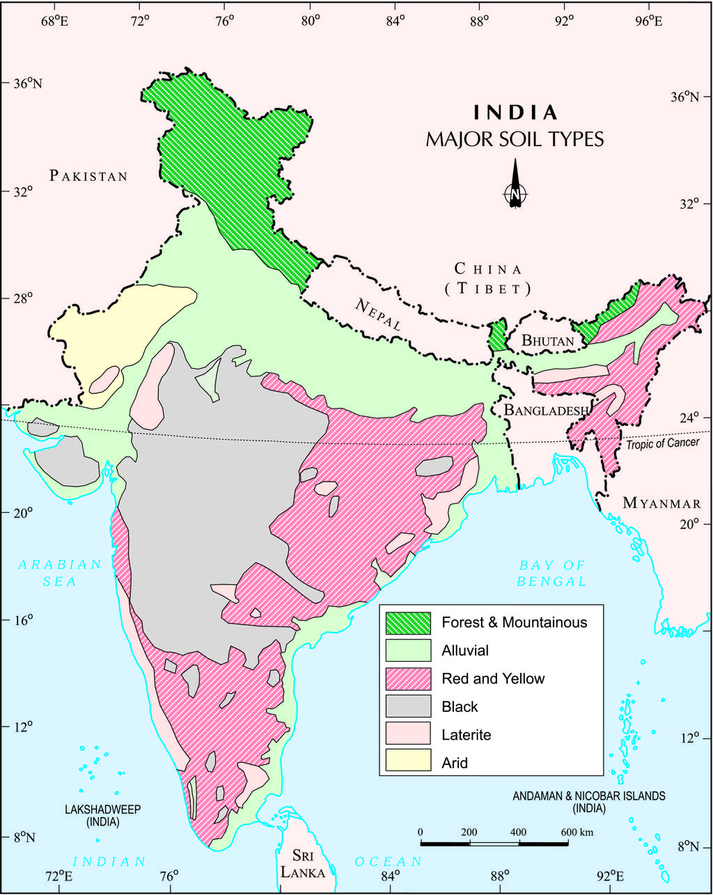
Q. Given below are two statements, one is labelled as Assertion (A) and the other as Reason (R). Assertion (A) : Red soil denotes the second largest soil group of India. Reason (R) : Red soil surrounds the black soil in the south, east and north directions.
Correct Answer: d) (A) is true, but (R) is false.
Explanation:
Assertion (A) states that red soil is the second largest soil group in India, which is correct. Red soil covers a significant portion of the Indian landmass, particularly in regions like Tamil Nadu, Karnataka, Andhra Pradesh, Odisha, and parts of Madhya Pradesh. It is formed due to the weathering of metamorphic and igneous rocks and is rich in iron, giving it a reddish color.
Black Soil 15%, Red Soil 18.5%, Alluvial Soil 40%
Reason (R) states that red soil surrounds black soil in the south, east, and north directions, which is false it does not surround in north direction.
Source: https://en.wikipedia.org/wiki/Major_soil_deposits_of_India
By ncert – http://nroer.in/gstudio/resources/images/show/35270/, CC BY-SA 3.0, https://commons.wikimedia.org/w/index.php?curid=27703297
Q. Which one of the following pairs (Crop – Peculiarity) is not correctly matched ?
Correct Answer: b) Bihar’s contribution to rice production – 15.7%
Explanation:
Maximum Share in Rice Production by any state is 12.17. So, Bihar can not have 15.7%
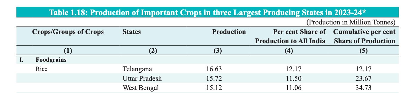
Source: https://www.indiabudget.gov.in/economicsurvey/doc/stat/tab118.pdf
Q. Which one of the following pairs (Crop – Peculiarity) is not correctly matched ? Read More »